Analysis of Wetland Misclassification
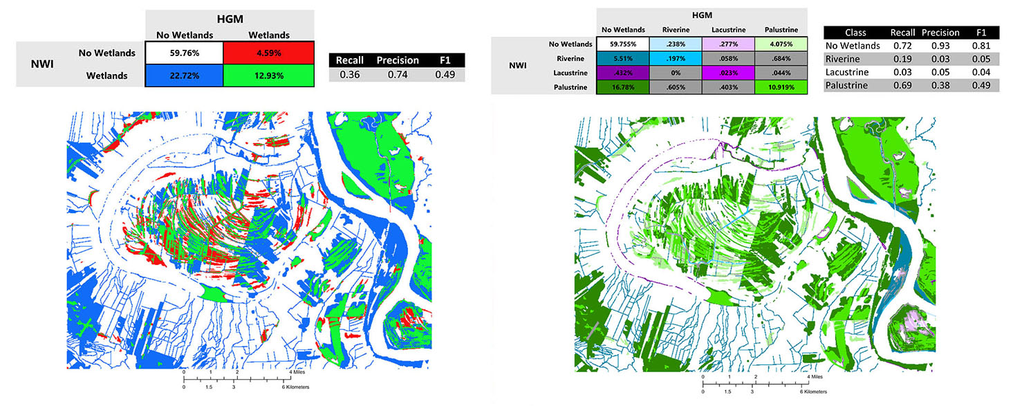
Another wetland case study complements the fragmentation study, analyzing uncertainty of wetlands classification by comparing two independently compiled wetlands databases across two levels of attribute resolution. The Cowardin classification forms a basis for the National Wetlands Inventory, and the Hydrogeomorphic classification is used to assess ecosystem functionality. The coarse attribute resolution (on the left) assesses the presence versus absence of wetlands. The fine attribute resolution confusion matrix compares not only the presence and absence of wetlands, but also the agreement of the specific wetlands type (riverine, lacustrine, or palustrine). Confusion matrices are embedded in a pyramid framework using a progressive focal window to record database agreement and disagreement across spatial resolutions. Recall, precision, and F metrics quantify uncertainty within each layer of the pyramid.

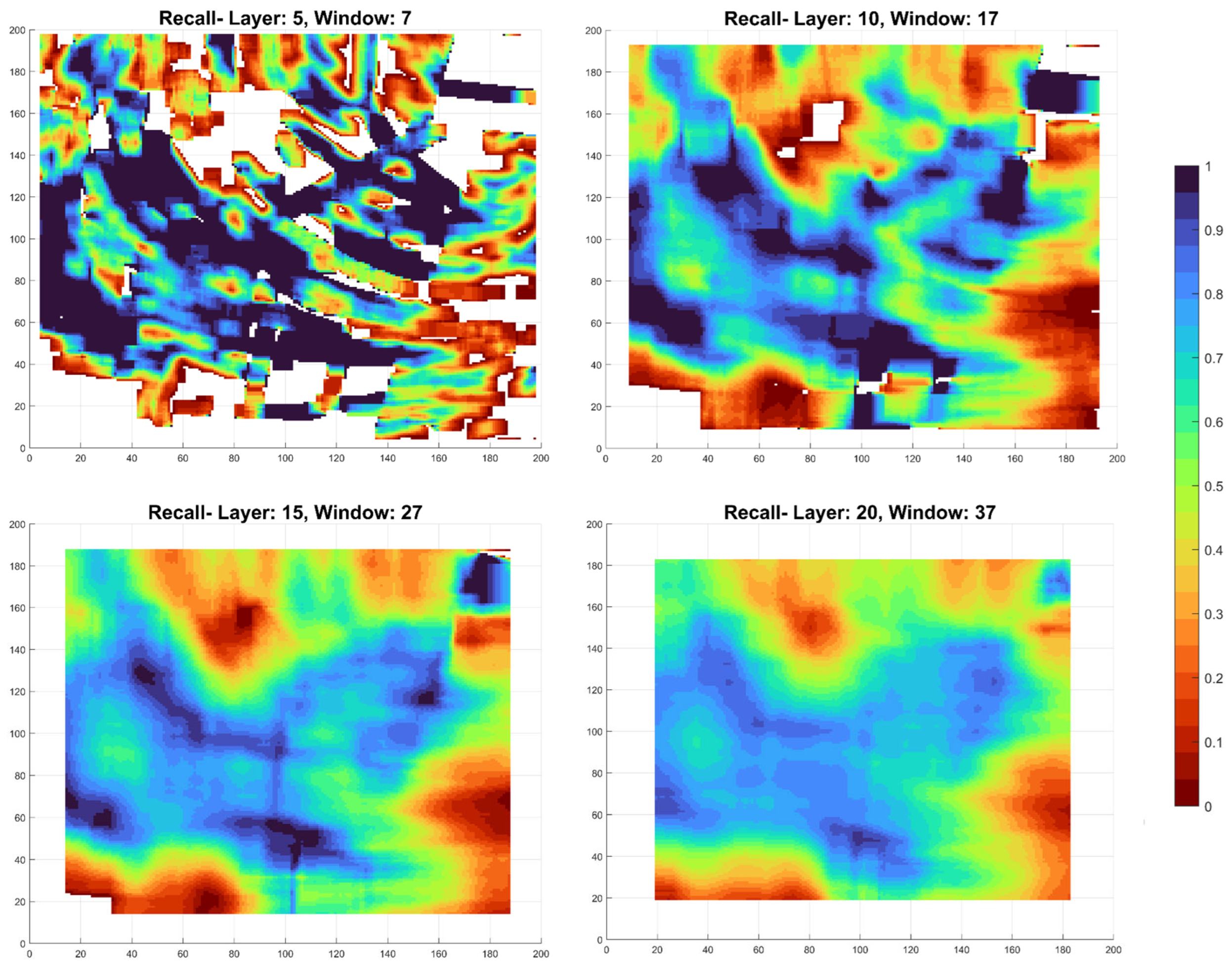
The figure below shows four slices from the recall pyramid, indicating misclassification calculated in from small focal windows to large. Layer number indicates the height in the pyramid and window number indicates the size of the focal window used in that layer.

Reference
Carlson K, Buttenfield BP, and Qiang Y. 2024. Wetland Classification, Attribute Accuracy, and Scale. ISPRS International Journal of Geo-Information 13(3): 103. doi: 10.3390/ijgi13030103.


